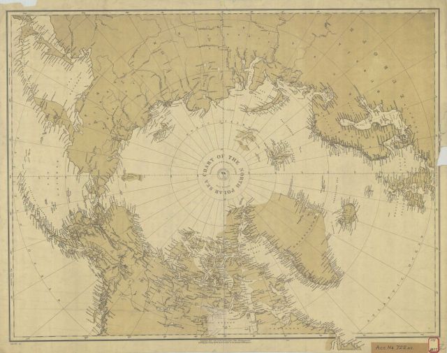
“Chart of the North Polar Sea” Republication of Brit. Admty Chart No. 260 by U.S. Navy Hydrographic Office. 1877.
Photo Category: Historic Ocean Cartography
Photo Date: 1877
| 640 x 505 | 63.01 KB | |
| 1280 x 1009 | 243.02 KB | |
| 1920 x 1513 | 539.93 KB | |
| 3073 x 2421 | 1.57 MB |
| Added On | 18th October 2015 |
| Viewed | 8 viewed |

")


