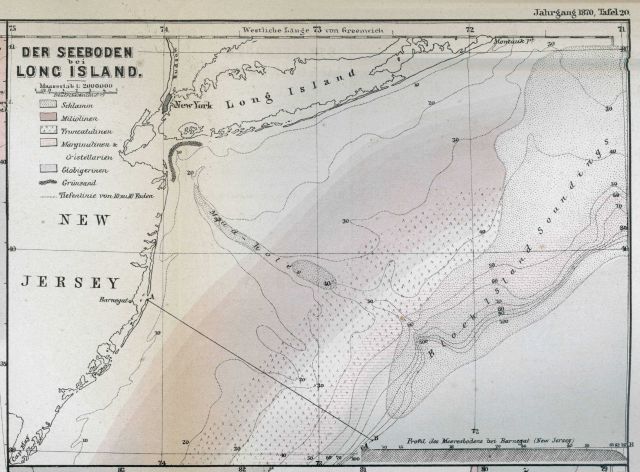
“The Sea Bottom off Long Island” as published by Petermann’s Geographische Mittheilungen in 1870. This map was drawn by Louis Francois de Pourtales of the the United States Coast Survey. Map shows head of Hudson Canyon, the canyon axis as shown by the Mud Holes as it crosses the continental shelf, and the sediment types.
Photo Category: Exploration - Maps
| 640 x 472 | 64.95 KB | |
| 1280 x 943 | 257.77 KB | |
| 1920 x 1415 | 561.01 KB | |
| 3000 x 2210 | 1.61 MB |
| Added On | 18th October 2015 |
| Viewed | 8 viewed |


")


