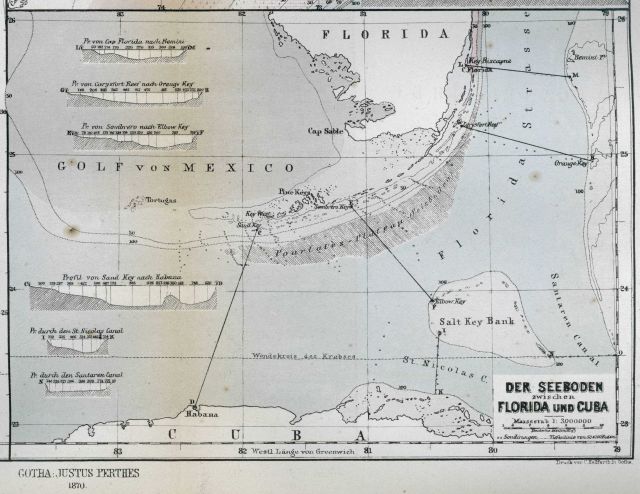
“The Sea Bottom off Florida and Cuba” as published by Petermann’s Geographische Mittheilungen in 1870. This map was drawn by Louis Francois de Pourtales of the the United States Coast Survey. Pourtales Plateau was named by Louis Agassiz, the first undersea feature off the continental shelf in U.S. waters that was discovered as the result of oceanographic exploration.
Photo Category: Exploration - Maps
| 640 x 494 | 66.77 KB | |
| 1280 x 987 | 253.84 KB | |
| 1920 x 1480 | 554.43 KB | |
| 3000 x 2311 | 1.59 MB |
| Added On | 18th October 2015 |
| Viewed | 5 viewed |


")


