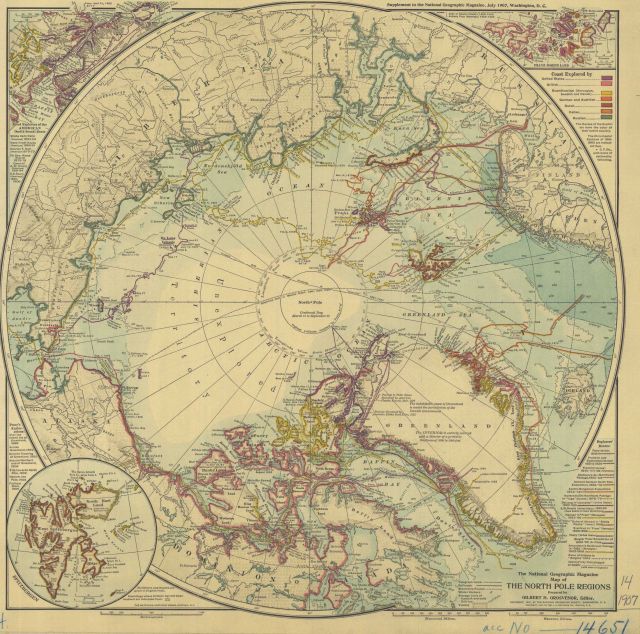
“The National Geographic Map of the North Pole Regions” showing discoveries and routes of explorers up to 1907.
Photo Category: Historic Ocean Cartography
Photo Date: 1907
| 640 x 634 | 117.97 KB | |
| 1280 x 1268 | 458.48 KB | |
| 1920 x 1902 | 980.86 KB | |
| 3255 x 3223 | 3.06 MB |
| Added On | 18th October 2015 |
| Viewed | 14 viewed |


")