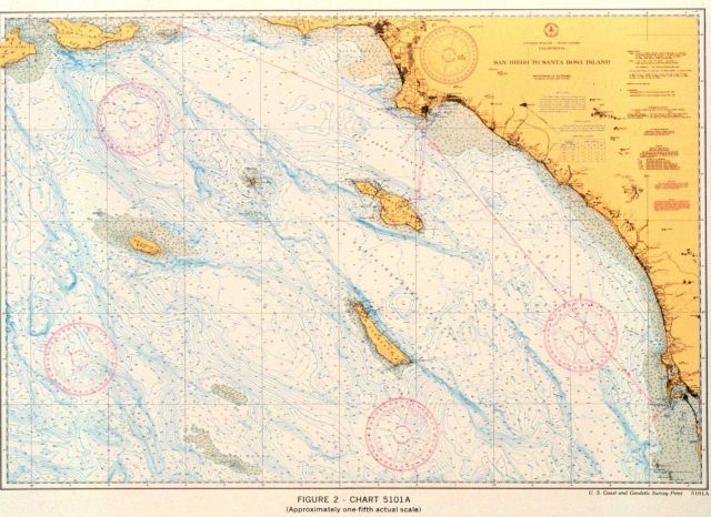
“New type” chart, San Diego to Santa Cruz Island, California, 1936. Chart incorporated bathymetric contours to show bottom detail as navigation aid
Photo Category: Charting - Charts
| 640 x 466 | 72.79 KB | |
| 1280 x 931 | 253.60 KB | |
| 1584 x 1152 | 477.76 KB |
| Added On | 18th October 2015 |
| Viewed | 8 viewed |