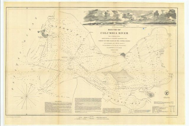
“Mouth of Columbia River” from a preliminary survey, including a view of the Entrance of Columbia River-Cape Hancock or Disappointment E. by N. (compass) 12 Statute Miles.” See cgs05094 for preliminary sketch of this area. The survey was conducted by Lt. W.P. McArthur and Lt. Washington Bartlett from the Coast
Photo Category: Coast and Geodetic Survey - Archive Hydrographic Survey
Photo Location: Oregon, Columbia River
Photo Date: 1851
| 640 x 428 | 45.99 KB | |
| 1280 x 855 | 171.12 KB | |
| 1920 x 1282 | 365.66 KB | |
| 2431 x 1622 | 663.58 KB |
| Added On | 16th October 2015 |
| Viewed | 8 viewed |