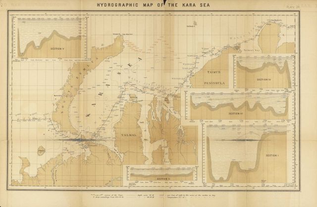
“Hydrographic Map of the Kara Sea”. Although unattributed, this appears to be data acquired during the voyage of the VEGA across the Northeast Passage be data acquired during the voyage of the VEGA across the Northeast Passage Swedish scientific expedition was Nils Adolf Erik Nordenskiold and the captain of the vessel was Louis Palander, a Swedish naval officer.
Photo Category: Historic Ocean Cartography
Photo Date: 1879
| 640 x 417 | 47.44 KB | |
| 1280 x 833 | 189.68 KB | |
| 1920 x 1250 | 446.51 KB | |
| 4261 x 2772 | 3.05 MB |
| Added On | 18th October 2015 |
| Viewed | 13 viewed |
| Downloads | 1 Downloaded |

")


