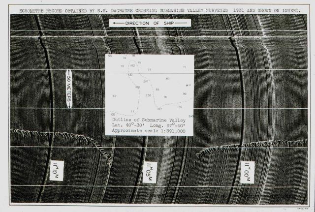
“Echometre” record obtained by the French liner S.S. De Grasse when crossing over the head of a canyon on Georges Bank. Such records reinforced the view that vessels could navigate by using bathymetry. Accordingly, the United States Coast and Geodetic Survey embarked on a project to map the continental slopes and shelves to help guide mariners into United States ports.
Photo Category: Exploration - Maps
| 640 x 431 | 88.24 KB | |
| 1280 x 861 | 340.03 KB | |
| 1588 x 1068 | 678.29 KB |
| Added On | 18th October 2015 |
| Viewed | 5 viewed |


")

