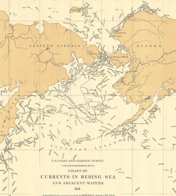
“Currents in Bering Sea and Adjacent Waters” by W. H. Dall, Assistant USC&GS. This early oceanographic map also showed the limits of ice in 1871 and 1877.
Photo Category: Coast and Geodetic Survey - Archive Oceanography
Photo Location: Alaska, North Pacific, Bering Sea
Photo Date: 1881
| 574 x 640 | 73.48 KB | |
| 1147 x 1280 | 259.12 KB | |
| 1720 x 1920 | 530.41 KB | |
| 2767 x 3089 | 1.40 MB |
| Added On | 20th October 2015 |
| Viewed | 5 viewed |