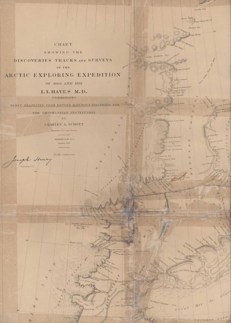
“Chart Showing the Discoveries Tracks and Surveys of Arctic Exploring Expedition of 1860 and 1861. I. I. Hayes Commanding.” Map compiled by Charles A. Schott of the U.S. Coast Survey for the Smithsonian Institution. Published in January 1865.
Photo Date: 1865
| 459 x 640 | 41.88 KB | |
| 917 x 1280 | 161.01 KB | |
| 1375 x 1920 | 368.50 KB | |
| 3104 x 4335 | 2.08 MB |
| Added On | 18th October 2015 |
| Viewed | 10 viewed |


 in flight.")

