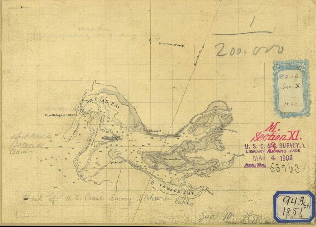
Although titled “Track of U.S. Coast Survey Schooner Ewing”, this is a preliminary version of the chart of the Mouth of the Columbia River. See image cgs05081.
Photo Category: Coast and Geodetic Survey - Archive Nautical Chart
Photo Location: Oregon, Cape Hancock
Photo Date: 1851
| 640 x 460 | 56.92 KB | |
| 1280 x 920 | 230.25 KB | |
| 1920 x 1380 | 497.99 KB | |
| 2538 x 1824 | 1.06 MB |
| Added On | 16th October 2015 |
| Viewed | 11 viewed |
| Downloads | 1 Downloaded |